Travel Day January 6th

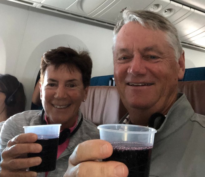
It’s a long way to Santiago Chile. From Miami between us we watched seven movies and enjoyed lunch and dinner (or was it two dinners – very confusing given the passage of time). It’s even even longer for Doug and Louise Pegg, our travelling companions, who are coming from Toronto. Based on a single experience I would give LATAM airlines a top rating for service and all aspects of the flight. OK we didn’t get crystal glasses but the Chilean wine was very nice.

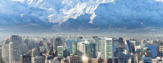
And our first exposure to Santiago was a pleasant surprise as the highways are pristine and numerous even if the ride in from the airport was spent in some of the longest road tunnels in existence. Very unlike Lima!

Our lack of Spanish and the cabbies minimal English resulted in our being delivered to a lovely hotel albeit not the one where we had reservations. Seems there’s more than one Pullman hotel in the same general vicinity of the city. A short Uber ride later we finally “arrived”.

The crazy currency exchange rate means simple items cost thousands of pesos. For example the cab ride was 24,000 pesos which sounds outrageous but actually translates to $31 US/$40 CAD. It feels odd carrying a couple of hundred thousand of any currency.

Weirdly Chile is two hours behind the eastern time zone even though it’s geographically west so our long day got even longer. Tomorrow we will explore the city.

Chile – Wine And Patagonia Adventure.

Here we go again. Having enjoyed Peru last May we decided, what the heck. Let’s go further south. So we’re off to Chile.

Chile is extremely narrow east to west but massive in length – it stretches the equivalent from Cancun, Mexico to Hudson’s Bay in Canada’s north. This means multiple eco systems such as the Atacama Desert in the north, the towering Andes mountain range that forms the country’s eastern boundary, and the famous Patagonia region in the south. And, of course, the iconic Easter Islands in the Pacific.

Our itinerary includes touring Santiago, visiting various wineries, a trip to the Pacific coast to Valparaiso (a UN Heritage site), then south to Patagonia and the Torres del Paine national park where we will kayak amongst the ice floes, hike and mountain bike (hopefully mostly downhill). The Patagonia region stretches across southern Argentina as well but we’re staying exclusively in Chile. And for those who wonder about these sorts of things, other than Antarctica, Chile is the southernmost country in the world, outdistancing Australia and South Africa by hundreds of miles.

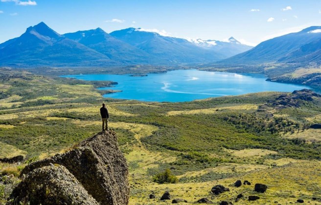
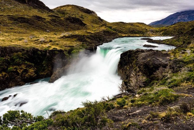
Despite the fact our internet access will be intermittent (especially in Patagonia) we hope to post regular updates on our travel blog. Here’s a sample of where we’re headed (photos taken by other travellers – hopefully ours are as good).

Lake Titicaca

Monday May 13.  Due to a pending demonstration by agricultural workers we were told it would be necessary to take the poor mans version of a tuk tuk to the port. These taxis rely on the operators pedal power and the passengers sit on an open bench.
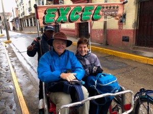
It was cold and our driver missed most of the potholes but not all. Fortunately for him much of the route was downhill.

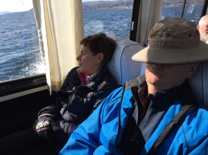
Our group was joined on the tour boat by another group and provided comfortable seating in an enclosed cabin, thank goodness, given an icy rain and wind descended on us.

Lake Titicaca, straddles the border between Peru and Bolivia and is one of South America’s largest lakes. It also is designated as the world’s highest commercially navigable body of water at 3,850 meters / 12,631 feet above sea level. Legend has it the Lake was the birthplace of the Incas.

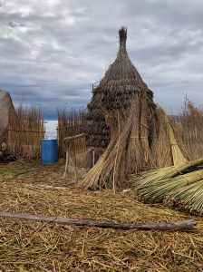
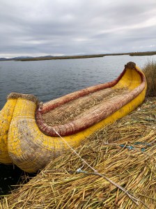
Our first stop was one of the approximately 120 floating Uris islands. Located about 7 – 10 Kms offshore where the water is still shallow, these structures are comprised entirely of reed found growing in the lake and the simple yet ingenious techniques used make them safe and secure. It’s hard to imagine but everything you see and come in contact with is made of reeds including the base.

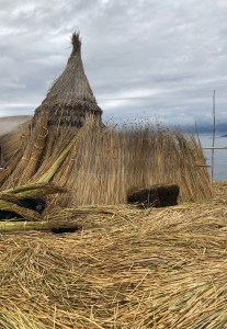
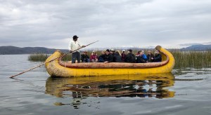
Of course the fact these islands are floating necessitates a regular topping up of the base.  To do so requires the lifting of the houses which can apparently be done by hand by the residents.  The 184 sq metre (1,991 square feet) island we were on supported five families including a 103 year old grandmother.  Modern conveniences such as lighting have been added through the use of small solar panels but other than that it’s reeds, reeds and more reeds.  We went for a short ride on the reed boat which felt as sturdy as any small craft albeit softer.
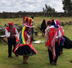
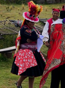
Next it was off to Taquile Island to learn how another cultural group has continued to use age old farming techniques and highly structured clothing symbols to maintain a unique identity. Here the males knit and the females weave. Different colours and items of clothing indicate ones marital status. Rituals and ceremonies dictate what one wears with one objective being to make it as bright as possible. Music and dancing, including enthusiastic visitors, are also a large part of life.

For those who enjoy eating quinoa, here’s what it looks like in the field.

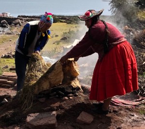
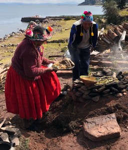
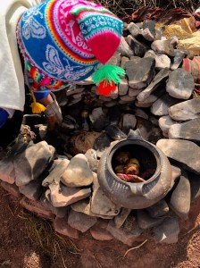
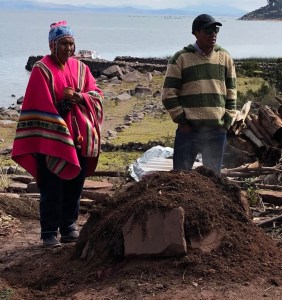
Our final stop was at the tip of the Capachica Peninsula for lunch cooked the old fashioned way – in a small semi subterranean rock cairn covered with dirt. Of course. One seriously hot fire, special stones and banana leaves to wrap some of the food were used. Cooking time is between 2 – 3 hours.  We enjoyed chicken, trout, different potato varieties, beans and bananas.  Delicious.
 

Back on the boat for the 1+ hour trip to Puno it was evident the last 15 days had caught up with us.
Tomorrow it’s off to Lima (1 1/2 hr flight) and sea level.  Looking forward to both aspects of our final day in Peru.
 

The Bus Ride

Sunday May 12.  Unfortunately we had to say goodbye to Cusco and pack up everything to relocate to Puno which is on the northwest shore of Lake Titicaca. More unfortunately, our means of transportation was our now 12 person bus with the luggage stacked up at the back and spilling onto the back seats. That in itself would have been fine (except in the case of a rapid stop).  Sadly though the trip was scheduled to take seven hours and the roads were less than ideal. Imagine a paved road with 1/2” of asphalt that has been beaten down by relentless traffic over the years (there’s only one road to Puno from Cusco). It felt like we were on a gravel road as one might find leading to a lakeside cottage. Except it went on for hours and hours!  There was the occasional respite but not much.

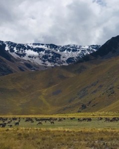
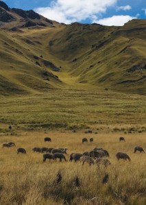
Puno is at the southern end of the Peruvian high plains and as such you could see the road stretch for miles in a straight line.  With the odd exception where one could see snow capped mountains, the surrounding foothills offered little in the way of distraction which made the journey seem even longer. We did see herds of wild llamas grazing by the road but that was it.

Puno, on the other hand is a relatively large city (138,000) with a huge percentage of the vehicles being tuk tuks.  These motorcycle cabs dart in and out of traffic, when it’s moving, and all credit to their drivers for somehow avoiding each other and any other metal objects.

We finally reached our hotel, played cards, had dinner and did our usual exhausted free fall into bed (having just learned the Raptors won on the last shot of the game). Tomorrow an eclectic day on Lake Titicaca begins with a 6 a.m. wake up. Oh yeah.

Cusco Peru

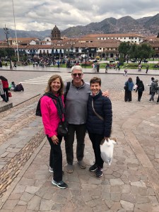
Saturday May 11.  A recovery day in a bustling city in the Peruvian highlands was just the tonic our bodies needed post Inca Trail. No crazy early wake up shouts, another hot shower, chairs with cushions and backs and only 12 steps down to the hotel restaurant for breakfast.  Luxury.
The Peggs had been in Cusco a year ago to visit their son as he wandered South America on a six month holiday so Doug acted as our tour guide. A guidebook description captures Cusco perfectly:  a beautiful schizophrenic city containing a devoutly Catholic community that is extremely proud of its Inca heritage.  Cusco was conquered by the Spanish in 1533 and fortunately retains multiple examples of centuries old Hispanic architecture.  Interestingly an earthquake in 1950 destroyed many colonial facades thereby exposing the Inca stonework hence the two coexist throughout the city.
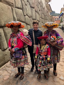
Today Cusco is a busy tourist town with a great vibe. There are hundreds (thousands?) of street vendors and countless souvenir shops on every street. Of course we fell for some of it.  Yes those are live baby alpacas.
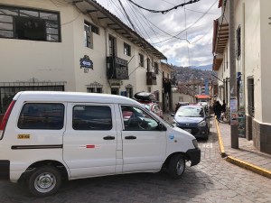
It includes a curious mix of broad boulevards and tiny cobblestone streets that work on the premise of whomever is further along a particular section dictates the direction of traffic. Needless to say we saw examples of gridlock where neither vehicle appeared to have any intention of backing up. We didn’t stick around to see how it got resolved.
One Inca building provided another example of their extraordinary masonry skills and included a famous stone with 12 finely cut edges – remember they didn’t have tools that explain how this precision was achieved.
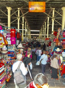
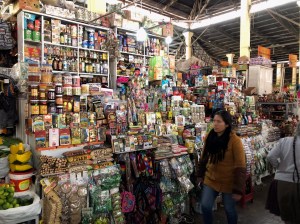
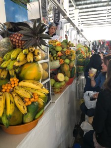
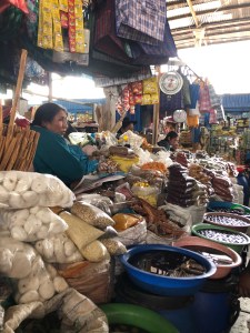
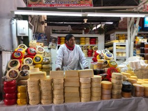
Cusco has an amazing market, both open and covered. It’s massive with various aisles offering a single grocery category.
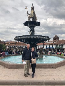
A hearty lunch followed by more recovery time at the hotel used up part of the afternoon. Then it was back out to visit a small section of one of the many Inca museums. We’re all running on fumes so it was a slow steady wander back through the main square and the hotel once more.
A team meeting explained our schedule for tomorrow – 7 hours in a bus heading to Puno on the shores of Lake Titicaca – then a few of us went back out for dinner.  The square was alive with marching bands and dancing which added a festive atmosphere.
Needless to say, sleep was very easy to come by.

Inca Trail Summary

Having had 48 hours to reflect I thought it would be interesting to show where we were and what we did.

For the four days we did between 26,800 and 35,238 steps per day. That’s from one of the trekkers fit bit so could be substantially different  for the rest of us. Given the wobbly legs, I feel like my numbers were WAY higher but who knows

The distance covered was 38.74 kilometres.  We had our heart rate measured mid hike and Mo and I were in the upper 90’s and our hemoglobin count was between 82 (Mark – marginal low end and 89 (Mo – excellent high end). The oxygen level was anywhere between 20 and 40% lower than at sea level

The elevation profile shown below is slightly different than the sign posts and guide comments. Our highest point was 4,215 metres/13,829 feet (thank goodness for Diamox- altitude medicine).

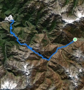
And finally, an overview of the route across the Andes from the start of the trail at Km 82 to Machu Picchu.

PS – we’re moving to a bungalow. No more stairs!

Inca Trail – Day 4

Our final day on the trail began with a 3:15 a.m. wake up tap on the tent and the words Machu Picchu today. That was enough incentive to get out in the pitch black freezing cold one final time. The early morning start has two purposes. It permits the porters to tear down the camp and transport the gear down the mountain to Aguas Calientes where a special train at 5:30 a.m. will carry them Urabamba for restaging by their various tour companies. For the trekkers it provides time to line up at a special entrance from where a 90 minute hike up Machu Picchu mountain will deliver us to the sun gate to witness the city of Machu Picchu be bathed in first light.

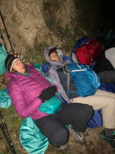
So we walked two hundred metres and queued up for an hour with the all the other trekkers waiting for the special entrance to open. Needless to say some handled the wait better than others.

At 5:30 the entrance to the trail opened and the trekkers set off wearing their miners headlamps. The trail stretches upwards for 1,000 metres and despite it being a relatively easy climb our legs were at the rubbery stage so even the flat sections required effort.

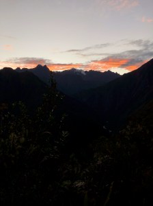
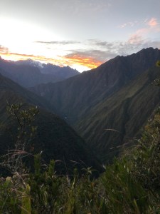
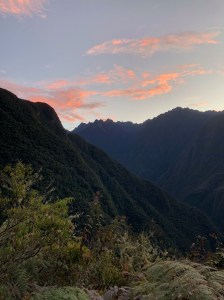
Again the rewards were multiple. The sun rise over the Andes Mountains to the east was breathtaking.

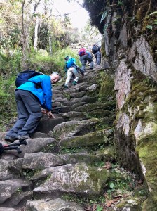
My fear was we wouldn’t make the 7 a.m. target for reaching the sun gate and thus miss the full sunrise above the mountains so we picked up the pace. That’s when we arrived at the monkey steps, so named because their steepness requires you use your hands to climb in some sections.

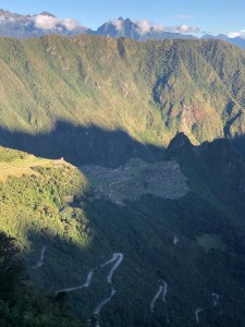
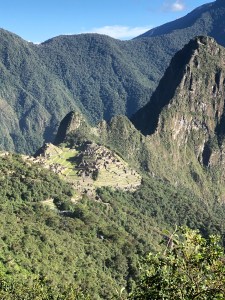
That last obstacle behind us it was on to the sun gate and our first glimpse of Machu Picchu. Fortunately the weather cooperated perfectly. While all the surrounding peaks were alight with sunshine the city was in shadows when we arrived high up on the south side of the mountain.

The shadows continued to recede.

Then the sun crested the eastern peaks and the city truly revealed itself. Time to celebrate our accomplishment.

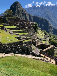
Of course our trek was not officially over as we had to walk down, 45 minutes, to actually reach the site. Not sure what the medical  condition is but we were all well past the rubbery leg syndrome and approaching muscle seizures. With Huayna Picchu as a backdrop we stopped with Louise & Doug Pegg at the iconic spot where likely more photos have been taken of Machu Picchu than any other.

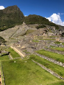
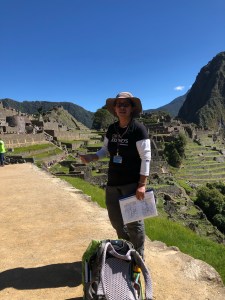
Then lead by our head guide extraordinaire, Wenny, we toured various sections of the city and learned interesting facts about its history, construction of sun angle measuring windows, and subsequent abandonment by the Incas.  Fascinating.

We were done. On to the bus to Aguas Calientes, a lunch in a building not a tent then onto the 90 minute train to Urabamba before finishing with a two hour bus ride to Cusco. In the hotel there we luxuriated in hot showers and real bathrooms before falling into the best soft beds ever made.

We did it!  What an adventure.

Inca Trail – Day 3

Today we are scheduled to cover 16 kilometres, the longest leg of the trek. Normally that may take a few hours on flat ground near sea level. We hope to do it in 11. Another 5 a.m. wake up call, another wear everything to breakfast and another creaking, groaning beginning to the hike. At least view from our front door wasn’t too shabby.

Today was mostly downhill which sounds easy but is actually more challenging and fatiguing than going up. Offsetting that fact was that a good portion of the day was spent in the cloud forest, the ecological transition from the mountains to the jungle. It’s hundreds of miles wide and we’re very much still in the mountains.  Sadly though the first two hour segment was a brutally steep, nearly 500 metre ascent to Runkuraqay Pass (3,950 metres/12,959 feet). At least the weather is clear, albeit cold as we looked back at Dead Woman’s Pass.

The cloud forest also had unique rock formations that created fissures through which the path passed.

At times we were above the clouds and occasionally in them.

At one point we had to edge around a llama who decide to forage along the edge of the trail. It seemed quite nonplussed as we slipped past.

There were sections which were down right gentle and we ambled along admiring flora and fauna and the occasional bird life.

Unfortunately it started to rain, then hail as we continued to descend so it was ponchos on for a second day. This storm was less severe than yesterday and didn’t impact the steps for as great a distance.

The storm passed and there was one last chance for a photo high above the Urabamba River.

The length of the day’s trek, the severity of both the first uphill segment, the storm and the constant downhill meant the last twenty minutes of the trek was done in the dark wearing our miners headlamps. It was indeed an 11 hour day of hiking. All the trekking groups and porters are congregated at a large, multi tiered campsite as tomorrow we make the “dash” to Machu Picchu. An early turn in as tomorrow starts at 3:15 a.m. Ugggh.
 

Inca Trail Day 2

Today is the big challenge at least in terms of ascending to the highest point on the Trail. We were awoken at 5 a.m. with the intention of being on the trail before six. Wrapped in multiple layers, jacket, toque, gloves, neck buff and wearing miners head lamps to get to the breakfast tent it was a cold start to what would be a long day.


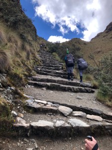
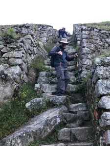
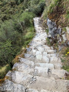
The Inca Trail is dominated by steps. Multiple stones of varying size make up each step with no consistency between them in terms of height, depth or edge quality.

Picking your way up or down a stretch of stairs requires intense concentration to choose the best route. A zig zag approach in the space of a few feet may in fact be the easiest way if you can save an inch or two in step height. Over thousands of steps over four days this technique can save your knees additional stress.  There are a few stretches of “flat” trail but even then it’s rough, inconstant stones that bend ankles and knees if you misstep.

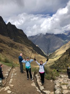
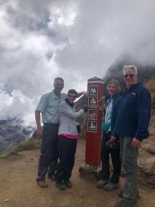
We changed our schedule and after two two hour stretches stopped for lunch before striking out for Dead Woman’s Pass, so named because the rock formation loosely resembles a woman in the supine position. During a no-step section Mark traded packs with one of the porters for about 50 feet. The admiration factor for what they do day after day, mile after mile grew exponentially.

It was a triumphant accomplishment to arrive at the top (4,215 metres/13,829 feet with about 60% oxygen vs sea level).

After a brief stop for photos it was down the other side.

At that point the heavens opened and we quickly donned rain gear and ponchos covering our backpacks. The steepness of the descent and the rain slicked rocks made it slow and treacherous. Because of the constant and heavy rain no one took a camera out for pictures. After three hours of exhausting stepping down we arrived at the campsite. It was perched between two rushing streams which in another place and time may have provided a soothing sound at bedtime. In this instance I don’t think anyone heard a thing as there was simply no energy left given we had been on the trail for over eight hours in the most challenging conditions. (Our camp, Paq’aymayu, was at 3,900 metres/12,795 feet and it was 2C/35F).  After another amazing meal we simply crawled into our sleeping bags and passed out.

The Inca Trail – Day 1

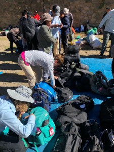
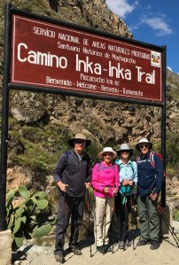
We were bussed to what is famously known as kilometre 82, the starting point for most trekkers. The large parking lot was a mass of activity given 200 trekkers per day are permitted on the trail. A further 300 porters/guides are also allowed. The logistics and organization was like a major military operation as everything, and I do mean everything, must be carried in backpacks.


Day on is described as a gentle introduction to the hike. Ha!  The altitude at the start is 2,660 metres (8,727 feet) which equates to approximately 25% less oxygen vs sea level. Despite the excitement and adrenaline it’s immediately apparent this is not your average Sunday stroll.
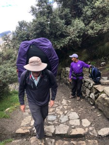
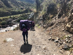
As we shuffled up the trail our 19 porters shot by us notwithstanding the fact their packs weighed up to 62lbs.  Humbling.

They rush ahead to set up camp where we will have lunch then tear it all down and race on to our overnight campsite to set up the tents and prepare dinner. The speed with which they travel is mind boggling.
Day one is described as being as “easy introduction” to the trek. If that’s the case god help us for what’s to come.
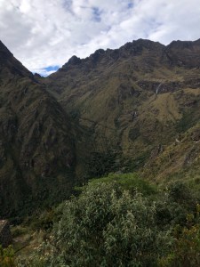
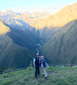
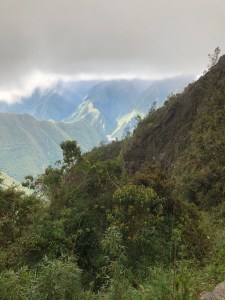
The scenery in the mountains was jaw dropping. We are truly in the Andes mountains now

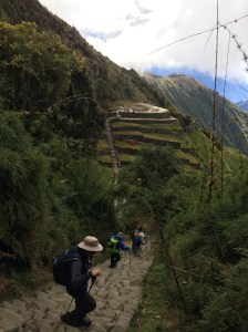
A constant sound, excluding my rasping breathing and heart beat pounding in my ears, was running water as dozens of brooks, streams and rivers crashed their way down the mountainside.  Each was more impessive than the previous one.   Our guides pointed out local flora and fauna and explained how it was used in the Peruvian diet or medicine cabinet. We also looked down on another significant Inca ruins that fell victim to the Spanish.

On we walked and after a few hours arrived at our camp for lunch. My description won’t do it justice. A cooking tent and a dining tent had been set up with the latter containing a long table and stools for 13 (11 trekkers and two guides as not all of our tour is doing the trail). Delicious hot food was served in multiple courses.  Remember everything had to be hand carried up the mountain.


Our afternoon session saw us arrive at campsite Wayllambamba (elevation 3,100 metres, 10,171 feet) where sleeping tents had been set up along with the cooking and dining tents. Again the meal was superb.  Our bodies may give out at some point on the trek but we will go down with a full stomach

We had rented air mattresses and sleeping bags however the former was about 3/4” thick fully inflated. Needless to say that wasn’t expected however given the porters carry that gear it’s understandable (trekkers carry a personal backpack with rain gear, personal items, some clothes, water etc.).
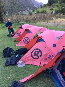
By 7:30 we crawled into our tents and except for a few barking dogs to spoil the tranquility, and it being 8C/46F, got in a good night’s sleep.