Inca Trail – Day 4

Our final day on the trail began with a 3:15 a.m. wake up tap on the tent and the words Machu Picchu today. That was enough incentive to get out in the pitch black freezing cold one final time. The early morning start has two purposes. It permits the porters to tear down the camp and transport the gear down the mountain to Aguas Calientes where a special train at 5:30 a.m. will carry them Urabamba for restaging by their various tour companies. For the trekkers it provides time to line up at a special entrance from where a 90 minute hike up Machu Picchu mountain will deliver us to the sun gate to witness the city of Machu Picchu be bathed in first light.

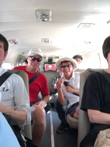
So we walked two hundred metres and queued up for an hour with the all the other trekkers waiting for the special entrance to open. Needless to say some handled the wait better than others.

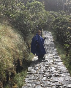
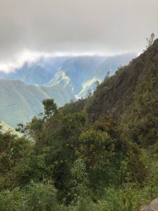
At 5:30 the entrance to the trail opened and the trekkers set off wearing their miners headlamps. The trail stretches upwards for 1,000 metres and despite it being a relatively easy climb our legs were at the rubbery stage so even the flat sections required effort.

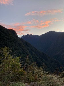
Again the rewards were multiple. The sun rise over the Andes Mountains to the east was breathtaking.

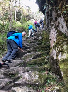
My fear was we wouldn’t make the 7 a.m. target for reaching the sun gate and thus miss the full sunrise above the mountains so we picked up the pace. That’s when we arrived at the monkey steps, so named because their steepness requires you use your hands to climb in some sections.

That last obstacle behind us it was on to the sun gate and our first glimpse of Machu Picchu. Fortunately the weather cooperated perfectly. While all the surrounding peaks were alight with sunshine the city was in shadows when we arrived high up on the south side of the mountain.

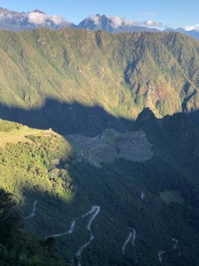
The shadows continued to recede.

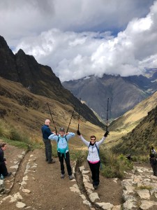
Then the sun crested the eastern peaks and the city truly revealed itself. Time to celebrate our accomplishment.

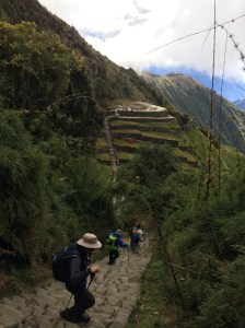
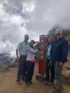
Of course our trek was not officially over as we had to walk down, 45 minutes, to actually reach the site. Not sure what the medical  condition is but we were all well past the rubbery leg syndrome and approaching muscle seizures. With Huayna Picchu as a backdrop we stopped with Louise & Doug Pegg at the iconic spot where likely more photos have been taken of Machu Picchu than any other.

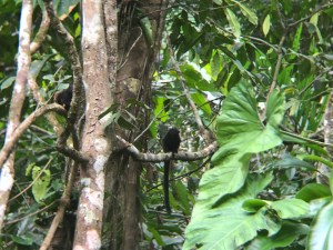
Then lead by our head guide extraordinaire, Wenny, we toured various sections of the city and learned interesting facts about its history, construction of sun angle measuring windows, and subsequent abandonment by the Incas.  Fascinating.

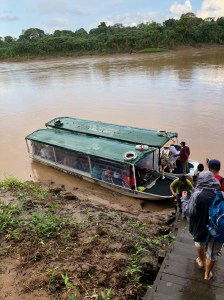
We were done. On to the bus to Aguas Calientes, a lunch in a building not a tent then onto the 90 minute train to Urabamba before finishing with a two hour bus ride to Cusco. In the hotel there we luxuriated in hot showers and real bathrooms before falling into the best soft beds ever made.

We did it!  What an adventure.

Inca Trail – Day 3

Today we are scheduled to cover 16 kilometres, the longest leg of the trek. Normally that may take a few hours on flat ground near sea level. We hope to do it in 11. Another 5 a.m. wake up call, another wear everything to breakfast and another creaking, groaning beginning to the hike. At least view from our front door wasn’t too shabby.

Today was mostly downhill which sounds easy but is actually more challenging and fatiguing than going up. Offsetting that fact was that a good portion of the day was spent in the cloud forest, the ecological transition from the mountains to the jungle. It’s hundreds of miles wide and we’re very much still in the mountains.  Sadly though the first two hour segment was a brutally steep, nearly 500 metre ascent to Runkuraqay Pass (3,950 metres/12,959 feet). At least the weather is clear, albeit cold as we looked back at Dead Woman’s Pass.

The cloud forest also had unique rock formations that created fissures through which the path passed.

At times we were above the clouds and occasionally in them.

At one point we had to edge around a llama who decide to forage along the edge of the trail. It seemed quite nonplussed as we slipped past.

There were sections which were down right gentle and we ambled along admiring flora and fauna and the occasional bird life.

Unfortunately it started to rain, then hail as we continued to descend so it was ponchos on for a second day. This storm was less severe than yesterday and didn’t impact the steps for as great a distance.

The storm passed and there was one last chance for a photo high above the Urabamba River.

The length of the day’s trek, the severity of both the first uphill segment, the storm and the constant downhill meant the last twenty minutes of the trek was done in the dark wearing our miners headlamps. It was indeed an 11 hour day of hiking. All the trekking groups and porters are congregated at a large, multi tiered campsite as tomorrow we make the “dash” to Machu Picchu. An early turn in as tomorrow starts at 3:15 a.m. Ugggh.


Inca Trail Day 2

Today is the big challenge at least in terms of ascending to the highest point on the Trail. We were awoken at 5 a.m. with the intention of being on the trail before six. Wrapped in multiple layers, jacket, toque, gloves, neck buff and wearing miners head lamps to get to the breakfast tent it was a cold start to what would be a long day.


The Inca Trail is dominated by steps. Multiple stones of varying size make up each step with no consistency between them in terms of height, depth or edge quality.

Picking your way up or down a stretch of stairs requires intense concentration to choose the best route. A zig zag approach in the space of a few feet may in fact be the easiest way if you can save an inch or two in step height. Over thousands of steps over four days this technique can save your knees additional stress.  There are a few stretches of “flat” trail but even then it’s rough, inconstant stones that bend ankles and knees if you misstep.

We changed our schedule and after two two hour stretches stopped for lunch before striking out for Dead Woman’s Pass, so named because the rock formation loosely resembles a woman in the supine position. During a no-step section Mark traded packs with one of the porters for about 50 feet. The admiration factor for what they do day after day, mile after mile grew exponentially.

It was a triumphant accomplishment to arrive at the top (4,215 metres/13,829 feet with about 60% oxygen vs sea level).

After a brief stop for photos it was down the other side.

At that point the heavens opened and we quickly donned rain gear and ponchos covering our backpacks. The steepness of the descent and the rain slicked rocks made it slow and treacherous. Because of the constant and heavy rain no one took a camera out for pictures. After three hours of exhausting stepping down we arrived at the campsite. It was perched between two rushing streams which in another place and time may have provided a soothing sound at bedtime. In this instance I don’t think anyone heard a thing as there was simply no energy left given we had been on the trail for over eight hours in the most challenging conditions. (Our camp, Paq’aymayu, was at 3,900 metres/12,795 feet and it was 2C/35F).  After another amazing meal we simply crawled into our sleeping bags and passed out.

The Inca Trail – Day 1

We were bussed to what is famously known as kilometre 82, the starting point for most trekkers. The large parking lot was a mass of activity given 200 trekkers per day are permitted on the trail. A further 300 porters/guides are also allowed. The logistics and organization was like a major military operation as everything, and I do mean everything, must be carried in backpacks.


Day on is described as a gentle introduction to the hike. Ha!  The altitude at the start is 2,660 metres (8,727 feet) which equates to approximately 25% less oxygen vs sea level. Despite the excitement and adrenaline it’s immediately apparent this is not your average Sunday stroll.
As we shuffled up the trail our 19 porters shot by us notwithstanding the fact their packs weighed up to 62lbs.  Humbling.

They rush ahead to set up camp where we will have lunch then tear it all down and race on to our overnight campsite to set up the tents and prepare dinner. The speed with which they travel is mind boggling.
Day one is described as being as “easy introduction” to the trek. If that’s the case god help us for what’s to come.
The scenery in the mountains was jaw dropping. We are truly in the Andes mountains now

A constant sound, excluding my rasping breathing and heart beat pounding in my ears, was running water as dozens of brooks, streams and rivers crashed their way down the mountainside.  Each was more impessive than the previous one.   Our guides pointed out local flora and fauna and explained how it was used in the Peruvian diet or medicine cabinet. We also looked down on another significant Inca ruins that fell victim to the Spanish.

On we walked and after a few hours arrived at our camp for lunch. My description won’t do it justice. A cooking tent and a dining tent had been set up with the latter containing a long table and stools for 13 (11 trekkers and two guides as not all of our tour is doing the trail). Delicious hot food was served in multiple courses.  Remember everything had to be hand carried up the mountain.


Our afternoon session saw us arrive at campsite Wayllambamba (elevation 3,100 metres, 10,171 feet) where sleeping tents had been set up along with the cooking and dining tents. Again the meal was superb.  Our bodies may give out at some point on the trek but we will go down with a full stomach

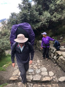
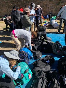
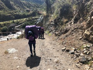
We had rented air mattresses and sleeping bags however the former was about 3/4” thick fully inflated. Needless to say that wasn’t expected however given the porters carry that gear it’s understandable (trekkers carry a personal backpack with rain gear, personal items, some clothes, water etc.).

By 7:30 we crawled into our tents and except for a few barking dogs to spoil the tranquility, and it being 8C/46F, got in a good night’s sleep.

Pot Holes, Speed Bumps and The Incas

Day 7 – Sunday. After sailing through the first week of our trip Mark was slammed by a bug (I thought Montazuma was Mexican, not Peruvian). A variety of different drugs seemed to mitigate the damage so with a full day of sights ahead of us it was onto the bus and off to Pisac, one of the many Inca ruins nearby. Trouble was the Peruvian roads are pockmarked with countless potholes meaning the bus driver slalomed down narrow mountain roads notwithstanding oncoming traffic. A further challenge is in the seeming absence of any police so they use speed bumps every few hundred yards to slow down traffic. And these are serious bumps. Stop, bump, go, slalom, repeat.
A quick history lesson:  despite their relatively small number the Inca tribe, following a battle with the neighboring Chancas in 1438 was able to conquer all of what is now Peru, parts of Chile and Ecuador and a section of Bolivia under the dynamic leadership of their ruler, Pachacutec. In turn their rule came was challenged by the Spanish invasion commencing in 1532 and after forty years of major battles and running skirmishes the last of the Inca armies was defeated and their place consigned to history. They left behind many ruins, the most famous being Machu Pichu (although most books designate other locations as more important cities based where the emperor lived and/or did battle.
Pisac, at the head of the sacred valley, features all types of architecture – agriculture using dozens of terraces on the mountainside, military, residential and religious including a cemetery built into the cliffs.

We wandered through the site and learned about ceremonies and some historical facts. Like the ancient Egyptians the Incas had the ability to move large stones great distances and construct walls with amazing precision.

Then it was off to the Potato Institute high in the hills.  Another heart stopping ride as the narrow road had no guardrails and it was hundreds of feet straight down. We learned more about potatoes than imaginable including that the tuber originated in Peru and this farm had 1,360 different varieties (too bad Ireland only imported one variety).  Today seeds are stored in Cusco and the world seed institute in Norway in case of disease. All the work is done by hand given the serious slope of the fields (and the remoteness of the farm). The head farmer demonstrated the seasonal work and techniques using a model  It was an impressive display of ingenuity and perseverance.
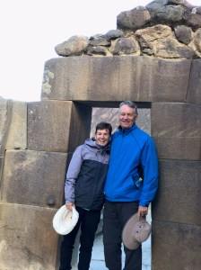
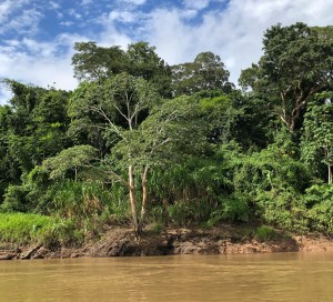
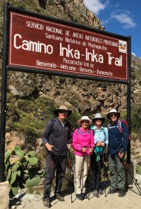
Back down to the river valley and along to Ollaytantambo which is a village of very bumpy cobbled streets too narrow for two way traffic. The main square gave the feel of a vibrant ski town given all the trekkers and street vendors surrounded by very large hills (we’re not quite in the Andes yet). This is the site of one of the more famous Inca – Spanish battles in 1537 where the former recorded a victory although it was a temporary setback for the invaders. Another Inca site was explored, explained and marvelled at give the construction skills and hoisting of massive rocks up mountains.

Back up the sacred valley to Urabamba for our last night in a real bed with a proper bathroom. Tomorrow the hike begins!

Jungle To City

Day  6 – Sunday. Into the boat one last time and we headed downriver back towards civilization.

Our 48 hours in the jungle and rainforest had been incredibly informative and interesting. On our last boat trip we stopped to watch a flock of macaws.  The vibrancy of colour was amazing.

Once back at the landing point we joined a bus convey back to Peublo Maldonado on that dusty track which wasn’t so dusty after the rains.

Back by air to Cusco and a chance to do a little exploring before the next phase. The streets in the centre of town are all cobblestone and the main square is very impressive. The history of Cusco stretches back thousands of years and is a major figure in the history of the Inca culture.

We attended an Inca Trail briefing and met the young lady who will guide us for four days and nights. Her experience gives me faith we will succeed.  We had a great dinner overlooking the square and wandered back to our hotel.

Here are the four slides showing our daily plans. We start at 8,727 feet and climb to 13,828 feet before descending into Machu Pichu four days later. Tomorrow will be an introduction to the sacred valley and two Inca village sites.

We’re off the grid for the next five days. Hopefully all of us enjoy this adventure. More to come.

The Rainforest

Day 5 – Saturday.  The damn alarm went off at 5:45 a.m. as we had to be away early to beat the heat. Ha. A short boat ride landed us in a portion of the rainforest where trails had been carved through the foliage.

Our local guides were incredibly knowledgeable and enthusiastic and for the next two hours we examined unique tree, animal and plant species. Trees unimaginably tall and broad to the point we could stand in amongst the root system, inside the tree!

Butterflies of every colour resting on our bodies as they looked to drink the sodium in our sweat. Monkeys, birds, insects, rubber, cacao (chocolate) and ironwood trees (the preferred source or parquet flooring), you name it, it was there under a towering canopy of green that limited sunlight and therefore bush on the forest floor (hence rainforest, not jungle).

Oh, and another tarantula encounter, with this one being even bigger – about the size of a large cell phone). It flinched, I leapt. Fascinating.

Back to the camp just in time to beat a massive rainstorm that created instant rivers everywhere. All the buildings only use palm leaves as roofing materials so fingers were crossed that we stayed dry. In the Amazon there are two seasons; rainy and really rainy. We’re just in the former so I’d hate to experience the latter.

There are a few working farms in the hundreds of square miles surrounding the camp and Mo and Louise were two of six in the group who braved the weather in the afternoon to visit one nearby to learn what an eclectic and widespread number of crops it produces.  The farm works closely with the lodge and makes the latter self sustaining for fruits and vegetables.

The rain didn’t let up until after dinner when our guide announced we were going on the river to search for Caimans which is a member of the alligator family. They are nocturnal and using a search light, our guide was able to pick out their reflective eyes as they floated near the shore. Fortunately the ones we saw where the smallest of the six varieties (4-5’ long) and not the black caiman which can grow to over 16’.

Back to the lodge for our final night as more rain was on the way.

Buses, Planes And Boats

Day 4 – Friday. A full day of travel awaited. Traffic, traffic and more traffic. Imagine trying to get to the airport in a city of 9M people, at rush hour using side streets because no highway exists. Oh, did I mention we were in a fairly large coach bus? Slow and occasionally unnerving given the game of traffic chicken is the norm.
Our flight actually involved a stop in Cusco before heading on to Puerto Maldonado, but not before the departure area was cleared while a bomb sniffing dog was brought in to examine a knapsack that had no apparent owner.  That meant everything was delayed and an hour spent on the tarmac waiting for takeoff given the queue.
Flying into the highlands showed the dramatic landscape changes from dry brown desert to sharply shaped mountains with hundreds of deep river valleys to finally the plateau of Cusco (800K population).

Farms abound with the wide plateau being more green than brown. Given the narrowness of the valley the airport is in the middle of the city and the landing approach was a bit unnerving with the final turn seemingly scraping the hilltops.


A quick turnaround at Cusco then back in the air to Puerto Maldonado which is very close to the Bolivian border. Rather than hills providing the plane landing talking point, this time it was the proximity of the rainforest.  A narrow strip of asphalt in a sea of green. On to a bus and off we went on a road, er no, a dusty track that bounced us around for nearly an hour before arriving at the Tambopata River which is a significant tributary of the Amazon River.

At that point the heavens opened and we had 10 minutes of monsoon type rain which pounded on the corrugated roof of the shelter we huddled under. Fortunately it stopped as quickly as it started and we set of in a motorized “canoe” for the 2 1/2 hour trek upriver.

The rainforest and jungle (open areas or formerly rainforest where falling trees created open spaces that is then overgrown by dense brush) looked impenetrable on each bank.


The camp (Tambopata Ecolodge) is comprised of 18 sleeping bungalows (total accommodation max 75), dining room and an under construction bar/meeting area. The main building is solar-powered for only a few hours a day with candles used for light elsewhere.  The food is hot and there are bathrooms with showers in each bedroom. It’s surprisingly comfortable.

We were immediately introduced to the uniqueness of our surroundings by going on a night walk looking for insects and other nocturnal creatures – seriously. It was a success although seeing a tarantula up close was a bit off putting as was another spider described as being 20 times more poisonous than a black widow. I figured we were safe in numbers and with the various flashlights wouldn’t get lost. Mission accomplished.

Despite the oppressive heat and off the charts humidity, by late evening we were so tired it didn’t matter and thus slept relatively soundly even without the mosquito netting.

Back To Lima

Day 3 – Thursday. Our trip north was uneventful save the now familiar police stop. This one was different as it wasn’t a roadblock but a “pull over you’re speeding” attempt to secure payment. Somehow our hand gestures and calm disputing worked and we avoided the fine. PS – we weren’t actually speeding.
My initial impression of Lima did it a complete disservice. The Miraflores area is a modern, clean and vibrant section of the city. Still virtually every business and any private car parking in front of the homes is protected by steel gates and razor wire in many instances.
The Lima weather is also noteworthy. Other than late December, January and February it is rare to have a sunny day. A haze and mist clings to the city although rain is virtually unheard of (less than 3” per year).  Temperatures, both hot and cool, are bearable but it must get a little depressing.

From high up on some serious cliffs Miraflores overlooks the ocean and is a world away from the airport area we experienced earlier. Here’s the reverse view

The hotel is very comfortable well staffed. Despite never having been I would equate its interior design to Havana 50 year’s ago. Unique decorations and use of old household items as bases for lamps were particularly appealing.
After a walk along the beachfront boardwalk,

having descended 305 steps (which of course meant we had to climb back up later – late training for Inca Trail?), we met our travel group and guide. Five Newfoudlanders, 3 Brits, 2 Americans and 6 of us from Ontario. Early reviews are quite positive although there are 3 Doug’s and 2 Louise’s.
Tomorrow is an early start as we fly to Puerto Maldonado which is our jumping off point for the Amazon segment. Although the camp (a further 2+ hours down river) offers many comforts there is no electricity so we will be off the grid until late on Sunday. Having had the warning do’s and don’t’s explained I should say hopefully we’ll be back Sunday.

Day 2 – Lows And Highs

Shades of a year ago (Cairo’s call to prayer sirens) our sleep was undone by the local populace celebrating May 1st Workers Day by exploding canon fireworks at 6:15 a.m. so it was up and at’m.  A very pleasant breakfast outdoors by the pool of the Las Dunas resort fortified us for a crazy day to follow.

The “low” was our personal proximity to the sand dunes as we threw caution to the wind and set off in a dune buggy driven a man who had obviously been an aerobatic pilot in a previous life. His mission was, apparently, to scare the crap out of his passengers by racing up, over, across and down giant dunes hundreds of feet high. Mission nearly accomplished.  We survived!

Then, if that wasn’t enough we slid down the dunes on special boards designed to ensure sand found its way into virtually every nook and cranny of our bodies. Mo especially, based on the screams, enjoyed herself.


Now most people would call it a day but nooooo, it was off to the local aerodrome to fly (the High) over the Nazca Lines. The origin of these ancient figures (circa 400 AD) in the desert has been debated for nearly a hundred years without a resolution. Our flight in a small 12 person Cessna took us south over the Ica valley.


Ica holds the distinction of having virtually no rainfall (~2mm/yr) yet boasts a thriving agricultural industry using a giant aquifer that is fed by the glacial melt occurring in the Andes mountains to the east. As with many other global areas, water consumption is exceeding replenishment but for now it’s a glaring example of man pushing back the desert to cultivate crops.

Seen from the air the Nazca lines form different figures and symbols. On the ground, however, they are not distinguishable given they are actually rocks removed from the surface, not rocks added. Sooooo, how were they created, especially since one depicts an astronaut? These are but a small sample.

In order to provide the best viewing and picture taking angles our pilot did a number of hard banks including one that touched 60 degrees. Just what our stomachs needed following our morning adventures. Then it was back to Ica with one last chance to marvel at Mother Natures ability to produce a stunning vista.

Back to Lima tomorrow (6 hour drive) where we will meet the other members of our G Adventure tour.  Whew.